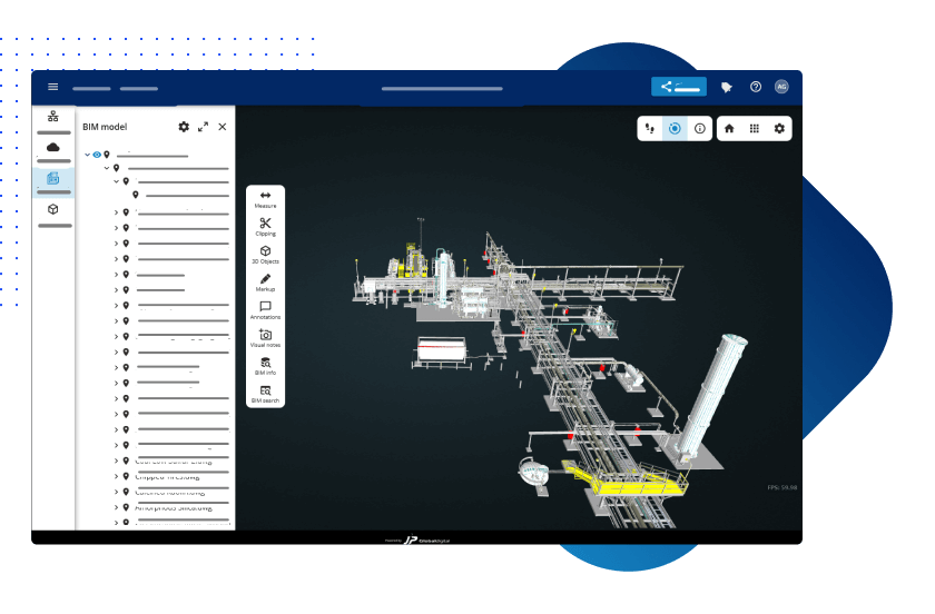
JP Interactive Viewer

Streamline and manage your reality capture and BIM data, including point clouds and 360-degree images, on our intuitive cloud-based application.

Compatible

Easily integrate diverse data sources, including terrestrial laser scanner, SLAM, and drone data. Compatible with most CAD formats, simplifying data management.

Connected

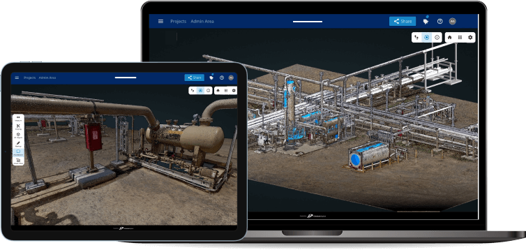
Cloud-based, real-time, reliable data access for seamless collaboration across teams and stakeholders. Stay in sync, collaborate in real-time, and access your industrial data from any device.
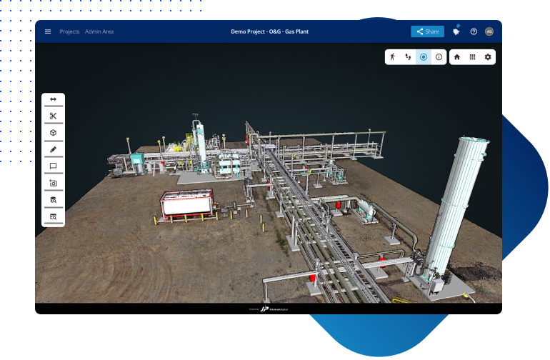
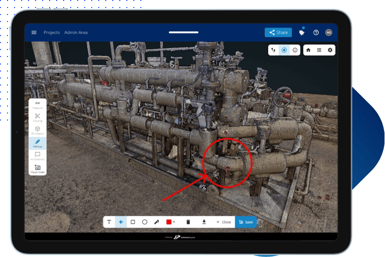
Visible

Effortlessly visualize large point clouds and gain powerful insights. Analyze with accuracy, ensuring precise project understanding and streamlined workflows.
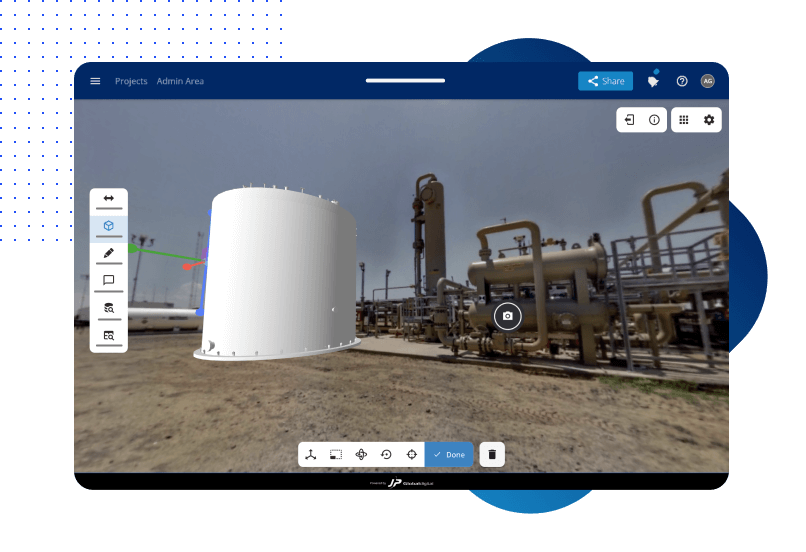
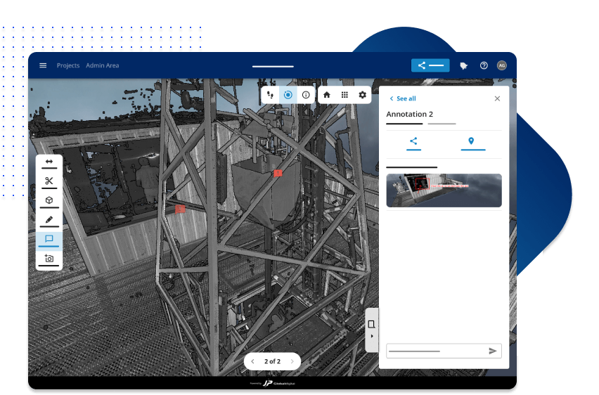
Simple

Access data on-site or remotely, ensuring quick, reliable, and secure information availability. Drive productivity with intuitive tools at your fingertips on the field and the office.

Reality Capture, BIM Management, and Visualization

Manage and visualize complex reality capture and BIM data, including point clouds, 360-degree images for comprehensive project understanding.

3D Object Simulation

Immerse yourself in the project environment with 3D object simulation, enabling realistic visualizations.

Advanced Search Tool

Easily locate project information with the advanced search tool, saving time and improving productivity.

"Now we've got a whole host of people that have access to the data and can use it on a day-to-day basis. They now have the ability at their fingertips to see [the data] interact with any of the other stakeholders as part of that project."

Adam Driggers - Director of Surveying and Scanning Services at Hargrove Engineers & Constructors

Real-Time Annotations And Comments

Communicate and collaborate with real-time annotations and comments, improving team coordination and efficiency.

Customizable Views

Tailor project views to focus on specific details, optimizing workflow and enhancing understanding for different stakeholders.

More features

Multiple sites

Access all your projects from a central dashboard and organize them based on locations or sites for structured management and easy access.

Virtual Walkthroughs

Experience a virtual walkthrough of your project by visualizing photorealistic 360-degree images, enabling immersive visualization of your site.

Share Project with a Link

Securely share project information and collaborate with stakeholders through just a link.

Download reality capture data and BIM

Retrieve point cloud and BIM models for offline access and utilization in other software or workflows.

Measurements

Accurately measure distances, areas, and volumes within your data for precise project analysis and documentation.

Clipping

Isolate specific sections of your 3D reality capture data and BIM for focused analysis and enhanced visualization.

Selection tree

Navigate and manage complex data hierarchies with ease, streamlining access to project components.

Mark Up tool

Annotate, highlight, and add comments directly onto your data for precise project analysis and documentation.

Visualize and Customize BIM Information

Effortlessly visualize and customize BIM information, gaining comprehensive understanding and analysis.

Generate Automated PDF Reports

Automatically generate professional PDF reports, saving time and enhancing project communication.

User Management

Efficiently manage user roles and permissions for controlled access, collaboration, and administration.

API Integration

Seamlessly integrate JPIV with other applications and systems for smooth data exchange and workflow automation.

Get Started with JP Interactive Viewer today

No credit card needed. Get access to JPIV today and experience all the benefits of having a single source of truth for your reality capture data and BIMs.

Learn How You Can Break Barriers In Reality Capture Collaboration

Working with reality capture can get tricky: from getting that data to the right people to communicating effectively and on time. Learn how you can easily collaborate and communicate with your team on reality capture data using JPIV.